Streamlining Community Forest Rights Claims in Malkangiri
BIPP-ISB has partnered with Malkangiri Gram Sabha (GS) to expedite the Community Forest Rights (CFR) claim filing process. We utilized the published claim forms of Integrated Tribal Development Agency (ITDA), to optimise time and effort. We customized the information required from the communities, notifications to be issued to process claims, details about Forest Rights Committee formation (FRC), inputs on village history, list of forest resources to meet our needs.
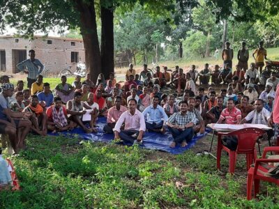
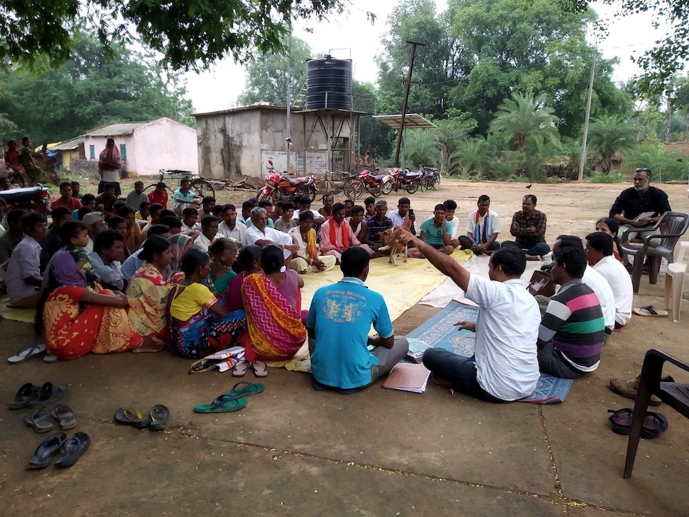
We first educated the tribes about their rights and the benefits of the Forest Rights Act. We sought help from the tribe’s leader and conducted meetings in their local language. The local communities were willing to start the CFR claim filing and build a forest economy when we along with their leader explained the benefits from the CFR titles. Our efforts led to the formation of Gram Sabhas and the Forest Rights Committees in each village, and 24 revenue villages were ready to file CFR claims. The mapping of forest boundaries was a major challenge, but we used GPS surveys, Google Maps, and a handy GPS device to create clear maps. We also submitted evidence of the communities’ dependence on forests to the SDLC.
The community people were hesitant to claim more than 10 acres of land due to a lack of proper understanding about the Forest Rights Act (FRA). With our intervention, FRA was understood entirely, and the community supported the claim filing process.
Our second step of the process was the formation of Gram Sabhas and FRC in each village. We collaborated with the sarpanch and ward members of the village to send notifications to the villagers. Twenty-four revenue villages were ready to file the CFR claims. We conducted quorum maintained GSs of 24 villages about the FRA and FRC, and CFR rights reservation claimed to file and formed FRCs.
Our major roadblock was the forest boundary mapping process. To clarify the boundaries between villages and shared forests, we employed a combination of techniques. This involved conducting GPS surveys, identifying points on Google Maps, linking them to create a boundary, and using a GPS tracking device. The resulting data was then compiled and converted into a GIS format, allowing for easy viewing and mapping on platforms such as Google Maps.
As the third step, we submitted an evidence document to the SDLC confirming the communities’ livelihood dependency on forests.
We anticipated conflicts between villages sharing the forest boundaries and set up a meeting to define an understanding between the villages for safe future transactions. The meeting was chaired by the Revenue Inspector, Panchayat executive officer, Sarpanch, FRC heads, and ward members was successful as the villagers agreed to utilize the forest resources with the permissions of the village leaders.
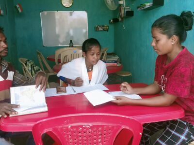
We gathered multiple departments involved to get the claim titles to complete the document verification together rather than as a sequence to save time. GS approved the claim documents and notified the SDLC, RI, forester, PO, Sarpanch, and ward members, for a joint verification of the claims. During the meeting, RI, Forester (and other government officials), and villagers completed physical verification of the claims.
To avoid conflicts, we held a meeting between the villages and government officials, where the villagers agreed to share forest resources with the permission of the village leaders. We streamlined the document verification process by bringing these departments together, which resulted in the successful filing of claims in just 7 days for each revenue village.
We have submitted the files to the SDLC and are waiting for the claim titles to be awarded. The total area of the revenue and reserve forest is being added, and we expect the process to be completed soon.