Digitally mapped CFR boundary demarcation in Nandurbar, laying the foundation for the forest economy
17.11.25
Making Rights Legible: Demarcating Community Forest Rights in Nandurbar, Maharashtra
Maharashtra leads India in the recognition of Community Forest Rights (CFR) under the Scheduled Tribes and Other Traditional Forest Dwellers (Recognition of Forest Rights) Act, 2006, also known as the Forest Rights Act (FRA). Yet legal recognition alone has not translated into economic empowerment. Across the state, communities hold CFR titles on paper but lack clarity on what those rights mean in practice: where exactly their forests begin and end, and what they are legally entitled to govern and benefit from.
While titles have been granted, precise boundary demarcation on the ground remains incomplete for many villages — creating ambiguity that limits communities' ability to plan, invest in, and benefit from their forest resources. Without clear boundaries, even the strongest legal rights struggle to take root.
A District Administration-Led Initiative
In November 2024, the District Collector, Nandurbar, assigned the CFR boundary demarcation task to Tata Institute of Social Science (TISS) Fellows deployed in the district — reflecting the administration's commitment to translating forest rights into ground realities. The Integrated Tribal Development Project (ITDP) Divisions of Nandurbar and Taloda issued formal letters to the Forest Department for Phase I villages falling under their respective jurisdictions, setting in motion a coordinated, multi-institutional process.
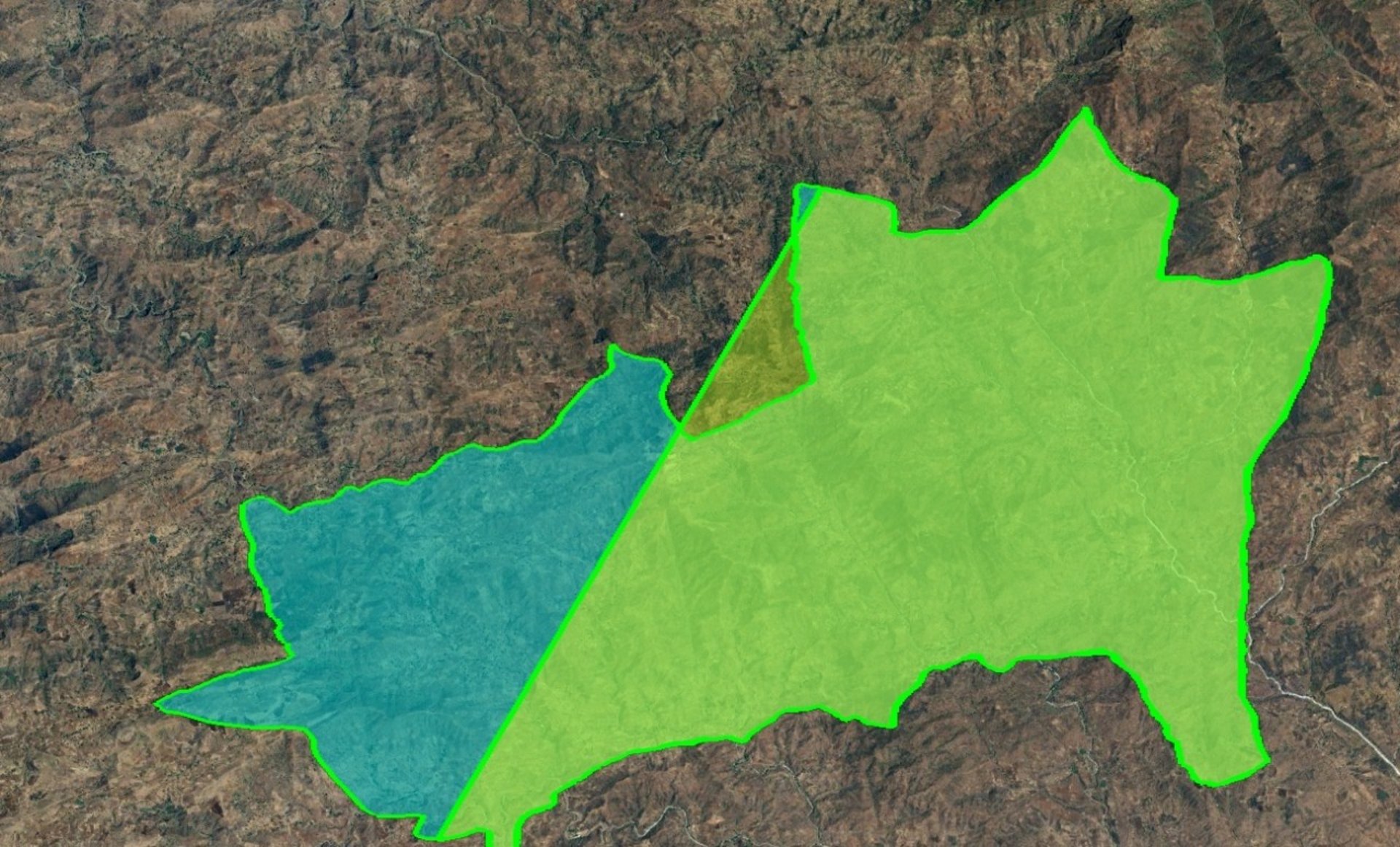
IoFE supported this initiative in close collaboration with the District Administration, working alongside TISS Fellows, the Forest Department, Community Forest Resource Management Committees (CFRMCs), and Gram Sabha members across villages. The goal: to clarify the precise extent of CFR for 10 villages spanning 10,960.47 hectares — translating legal titles into ground-truthed, documented boundaries in Phase I.
Village by Village: How the Demarcation Works
The process begins with an orientation and training session in each village. Gram Sabha members, CFRMC representatives, Forest Guards, and TISS Fellows come together to understand the methodology, learn to use a mobile application and Google Earth for digital boundary recording, and review village maps and boundary details prepared by ITDP.
Critically, the exercise is rooted in community knowledge. Participants are invited to identify the forest tracks they customarily use — ensuring that boundaries reflect lived patterns of access and stewardship, not just administrative records. Based on this, participants are organised into field teams, each assigned a route they themselves have identified. Teams proceed simultaneously along their designated tracks and converge at a pre-identified common point to complete the demarcation in a coordinated and transparent manner.
Where relevant, teams also identify bamboo-rich and accessible harvestable patches during the demarcation walk — directly linking rights clarification to resource mapping and future market readiness.
Laying the Foundation for the Forest Economy
Demarcation has been completed for five villages — Kotbandhni, Nagziri, Kelapani, Bhadal, and Legapani — covering 9,710.67 hectares. In Kotbandhni alone, 3,399 hectares were demarcated in a single day, with field teams comprising TISS Fellows, Forest Guards, and villagers working in parallel across the landscape.
Work is ongoing for the remaining villages; the outcomes of this exercise will enable ITDP to correct the Record of Rights (RoR) for each village — ensuring that legal documentation accurately reflects ground realities and the customary use patterns of forest-dependent communities.
CFR boundary demarcation is a foundational step in IoFE's broader work in Nandurbar. Clear, legally documented boundaries are a prerequisite for communities to plan sustainable harvests, attract institutional support, and assert their rights in the marketplace. By anchoring rights in the landscape itself — not just in administrative records — this work lays the ground for everything that follows from forest product aggregation and trade to long-term ecological stewardship.